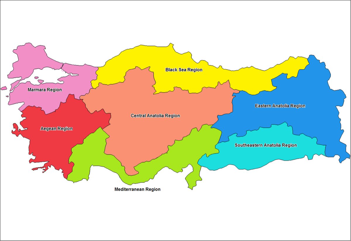
The First Geography Congress that assembled in Ankara in 1941 divided Turkey into seven geographical regions as a result of the long-lasting studies. The factors that have been taken into consideration in the studies of the aforesaid congress are the position of Turkey surrounded with seas from three directions, the mountain ranges parallel to the coasts along the long edges, the separation of the central regions that are less rough from the coastal regions by these mountains, the distribution of the climate, natural plant cover, and type of agricultural products between the coastal line and the central regions due to the separation by the mountains, and the effects of this separation upon the communication systems and the housing types, etc. Therefore, it was possible to divide Turkey into four coastal regions and three central regions. The first four regions among the seven regions that were determined were called with the name of the neighbouring seas (Black Sea, Marmara, Aegean and Mediterranean Regions). The other three regions were named in accordance with their locations over the entire lands of Anatolia (Central Anatolian, Eastern Anatolian and Southeastern Anatolian Regions). Turkey is located over the Alps-Himalayas range zone that is one of the most important seismic zones in the world. There are numerous active faults in Turkey including the principal fault of Northern Anatolian fault that passed along the country. There have been 7 earthquakes that took place on the Northern Anatolian Fault plane within the last century that began in Erzincan in the 1939 and followed a regular progress from the east towards the west along the fault line. The last Marmara earthquake with the central base of Izmit occurred with the intensity of 7.4 on the date of 17th August 1999 and this earthquake took place in the Eastern Marmara section of the Northern Anatolian fault line. Marmara earthquake that has been qualified as the Disaster of the century has been the most intensive earthquake that took place in the history of Turkey pursuant to Erzincan earthquake in 1939.
The Marmara earthquake that took place in the wide region that has the highest density of population in Turkey has lead to terrible sacrifices of lives and damages particularly and mostly the cities of Izmit, Yalova, Sakarya and Bolu and in the neighbouring cities of Istanbul, Eskişehir, Bursa and Zonguldak. In this earthquake, over 15 thousands of people lost their lives and over 25 thousands of building collapsed and nearly 200 thousands of housings and workplaces were damaged. Turkish government that set in motion immediately after the earthquake mobilised all its facilities in order to heal up the wounds of the earthquake. Totally 83 countries including particularly Germany, Israel, Greece and Russia sent rescue teams and various materials of aid. Additionally, aid campaigns were initiated in Turkey and in several countries of the world in order to provide help and assistance to those who were damaged in the earthquake within the structure of both the governments and the non-governmental social organisations. This international solidarity and sensitivity that came into existence pursuant to the earthquake have been received with the feelings of appreciation and gratitude by all of the Turkish people.